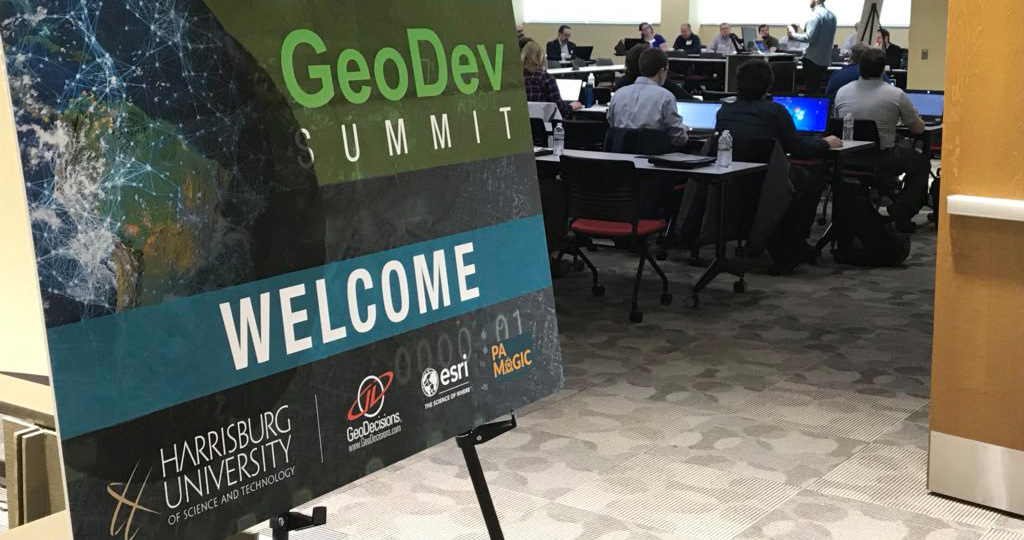
GeoDev Summit
Thursday, February 29, 2024

What is GeoDev? Are you getting the most out of your geospatial data? Do you need to build map-driven apps and solutions? Spatial data analysis, statistics, and visualization are data science specialties where geospatial development (GeoDev) optimizes the use of data. Did you know an estimated 80% of all data has a spatial component? If your organization uses spatial data or could use it in the future, see examples from industry professionals showcasing the scripts and applications that are generating value from spatial data. Both application developers and data-heads alike will benefit from hands on demonstrations and examples of the power of GeoDev. Consider attending the GeoDev Summit at Harrisburg University!
About the GeoDev Summit: If you want to expand your data analysis tool kit and create interactive mapping visualizations, then this summit is for you. The GeoDev Summit is a one-day professional development opportunity providing attendees technical workshops and presentations led by industry professionals to take your data analysis and visualization game to the next level. Let’s get spatial!
Benefits: Whether you are an organization leader, an application developer, a data scientist, or are just interested in learning how to leverage your spatial data, the summit provides valuable insights into the newest tools and leaves you with techniques you can use immediately in your current work. The technical peer interaction and discussion are an irreplaceable network of support.
For GIS Professionals (GISP’s), or those working to obtain the certification, this summit qualifies for 1 GIS-P Education Point [gisci.org].
Meet This Year's Keynote
Christopher Tracey
As Director of Spatial Analysis at NatureServe, Chris is responsible for maintaining and improving NatureServe’s spatial data offerings, as well as working closely with NatureServe’s network of data providers to ensure that NatureServe data is of sufficient quality and breath to address today’s pressing conservation needs.
Chris joined the Pennsylvania Natural Heritage Program in 2005 as an inventory ecologist, conducting surveys for tracked plants and animals, and finished his time at PNHP as the Conservation Planning Manager. In this role, he focused on creating biodiversity data products to support conservation efforts, planning, and decision making by local, state, and federal government and conservation organizations. He is trained as plant ecologist and botanist, but also has experience with freshwater mussels, bees, and butterflies. He has provided key support for Pennsylvania’s Wildlife Action Plan, including habitat mapping and the development of decision support tools to facilitate agency as well as public use of the plan. He also brings experience in species habitat modeling, particularly for aquatic species. Additionally, Chris has participated in the development of Key Biodiversity Area standard and currently serves as a member of the KBA Technical Working Group. He holds a B.S. in Ecology and Evolution from the University of Pittsburgh and an M.S. in Conservation Biology from Bowling Green State University.
NatureServe is an international non-profit organization dedicated to conserving biodiversity through the use of science, technology, and collaboration. For nearly 50 years, NatureServe has been the authoritative source for biodiversity data throughout North America. We work with 60+ network organizations and 1,000+ conservation scientists to collect, analyze, and deliver biodiversity knowledge that informs conservation action. Through our development of a shared spatial database, NatureServe provides analysis and visualization on at-risk species, habitats, and ecosystems. NatureServe has used GIS to support a variety of conservation initiatives, from identifying critical habitats for endangered species to analyzing the impacts of climate change on biodiversity. GIS has also been instrumental in developing tools and resources to aid conservation practitioners, such as the NatureServe Explorer database and the Map of Biodiversity Importance.

Thank You to Our Sponsors


